

| |
Starting fom February 2012 GISCAT offers specialised services for MAV / UAV aerial image processing also on our new website WWW.AEROGIS.DE. |
 | Digital aerial images up to a size of 21 megapixel in RGB standard color mode, as well as up to 10 megapixel near infra-red false color composites and thermal infra-red images with VGA resolution |
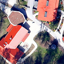
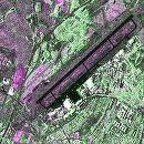
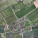 | Optimized single images, image mosaics, geo-referenced image mosaics and image maps from digital aerial and satellite images |
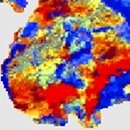
 | Digital surface models, e. g. detailed forest canopy models or three dimensional surface models of open cast mining areas |
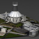 | 3D reconstruction of buildings, industrial plants etc. , starting from simple LOD 1 models up to fully textured LOD 4 models |
 | Large area Mapping of natural and environmental hazards, e. g. storm damage mapping in forested areas |
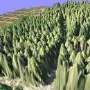
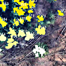 | Automated tree counting and tree height determination for forested areas from multi-view stereo images |
 | Training courses in remote sensing basics, digital image processing, analysis of synthetic aperture radar images and the processing of lidar data using open source tools. |